Probably the most detailed and broad ranging of these early maps are from the collection from the Public Land Survey System (or Cadastral Maps). These were generated throughout the 1850s in the Portland metro region, with the main portion of Portland encompassed in two maps, which were obviously the base material for the 1852 Survey Map, as it contains much of the same data.

Zooming in a bit on the area of current downtown Portland, we see the nascent grid forming along ‘The Clearing’, and see the edge of the Tualatin Mountains (West Hills) to the west, even a trail leading toward Beaverton through a slot in the Canyon where Highway 26 west (Sunset Highway) runs. On the east side of the river is the lowland marsh and streams that were subsequently filled to create the Central Eastside Industrial area. Within the Willamette River to the south, Ross Island is intact, well before the constant sand and gravel mining operations left it a ribbon of it’s former self.
The detail is pretty awesome, as you really get a feel for some of the drainages that existed, still in visible dendritic forms making sub-watersheds. This section also shows the routing of a ‘road’ that connected to Milwaukie and Tualatin to the south.

The northern section captures the upper reaches of Downtown, as well as the current Pearl district and Northwest Industrial Zone. Closer to downtown, the original routing of Tanner Creek is made evident by it’s headwaters at the ‘Tannery’ adjacent to the road to the Tualatin Plains. This fed Couch Lake, a wetland adjacent to the Willamette that is currently the location of Tanner Springs Park, a metaphorical daylighting of this lowland. Finally, in the pre-bridge era, the location of ferry crossings connecting east and west are shown 
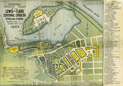
Another notable items on the upper west includes Guilds Lake, a significant water body that was the site of the 1905 Lewis and Clark Exposition, designed by Frederick Law Olmsted – which was later filled to create flat industrial land as it exists today.

:: image via Portland History
Taking a closer look at the northernmost section you see the level of detail shown in the marshy edge of the Columbia River called on the map ‘Columbia Bayou’ and some of the earliest low-density riverfront inhabitation.

I really love this map for many reasons, but the fact that it is referenced to the township, section, range mapping convention, making it easy to use as an underlayment for modern mapping to show a pre-development (or at least early development snapshot of Portland context). It also shows a relatively wide span of the region, making it useful beyond the boundaries of Portland.
I have created a few of these maps over the years which I will post when I get a chance). My ultimate goal is to reconcile these into a graphical layer in GIS that can be used for mapping analyses… any grad students out there want a project? (Find many of these maps from this post and the previous ones at the great City of Portland Publications and Maps Page)

Jason, these historic maps are great! Makes it feel as if we are peeling back the layers of time.
Seems the “road between Milwaukie and Tualatin” follows the route of the current SW Military Road and then SW Terwilliger and SW Boones Ferry Road. The large drainage system shown is of course Tryon Creek (State Park). Keep posts like this coming!
Martin.
Glad you enjoyed them. I definitely seem to spend a good amount of time maneuvering around these maps, getting lost in them. It’s great to overlay and see the connections between the past and present urban conditions. More to come for sure.
Cool maps indeed. I was looking at these the other day through U of O’s site then found your post on them as well. Would be very fun to play with some historic GIS data. Well, turns out there is some out there! Check out (http://www.upa.pdx.edu/IMS/currentprojects/TAHv3/GIS_Data_Home.html) for some interesting data; historic trolley lines; old town, china town, japan town boundaries; old town vice/arrests data. Cool stuff.
Mark. Thanks for the link – will have to check out the resources there. JK