The Map of American Rivers has been out for a while – and this post has been sitting in my drafts – so figured i’d finish it up. The beauty of the map, created by Nelson Minar, is the isolation of a single elements and it’s expression in the topography of the US. I think of glaciers cutting through North Dakota, and massive basins such as the Columbia River watershed, and the patterns at nested scales.
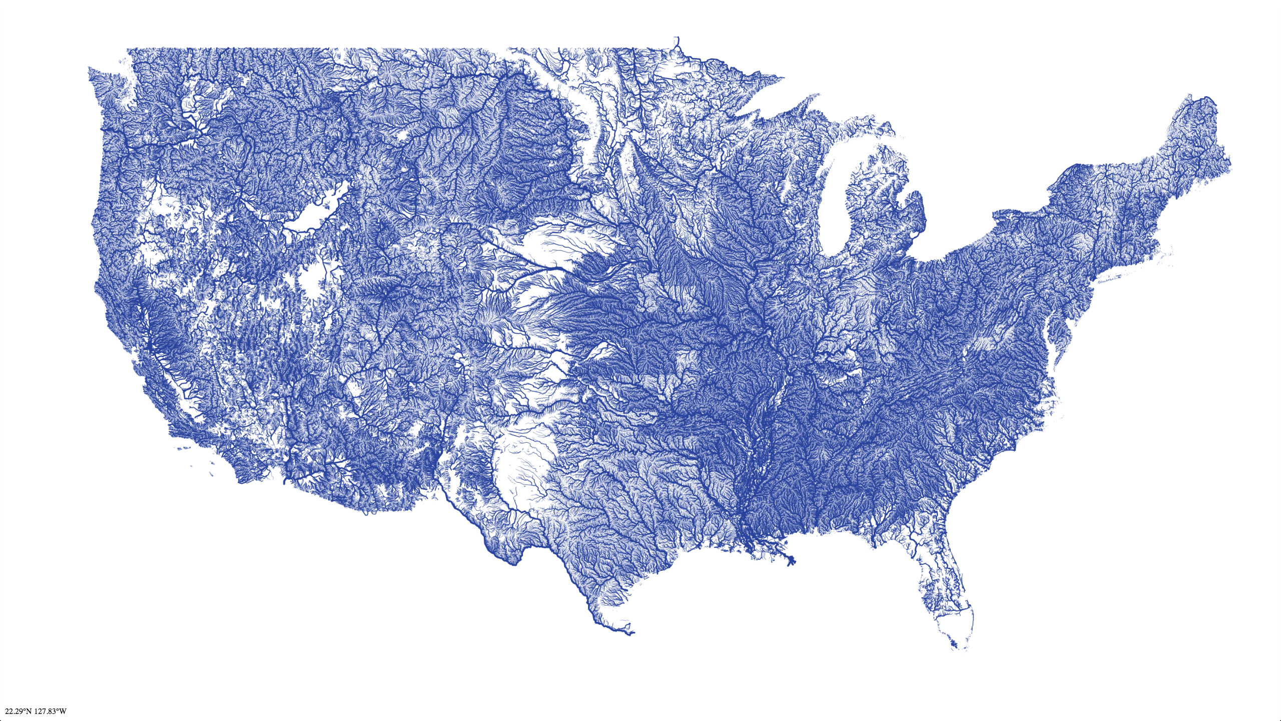
When zoomed in, you get the dendritic, branching structure of watersheds that evokes biology, as mentioned in the Urban Times post: “The way they scatter in patterns and formations across the country makes it look like a giant lung. Pumping water along its veins, arteries and capillaries, The United States of America moves forward.”
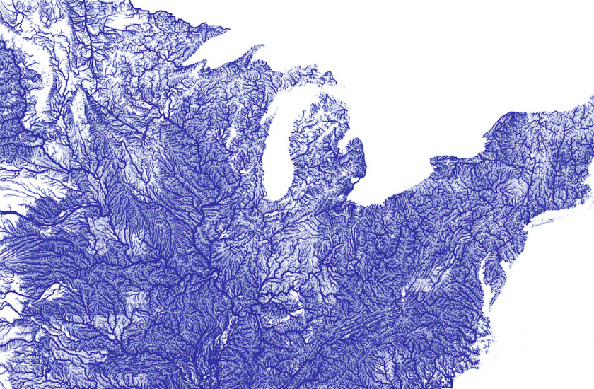
It evokes for me the book River Horse by William Least-Heat Moon, a chronicle of the impossibility (and success) of crossing the country (ala Lewis & Clark) by boat. Pick a channel, navigate (if possible) and who knows where one will end up — i’m guessing eventually to the ocean.
One thought on “River Maps”