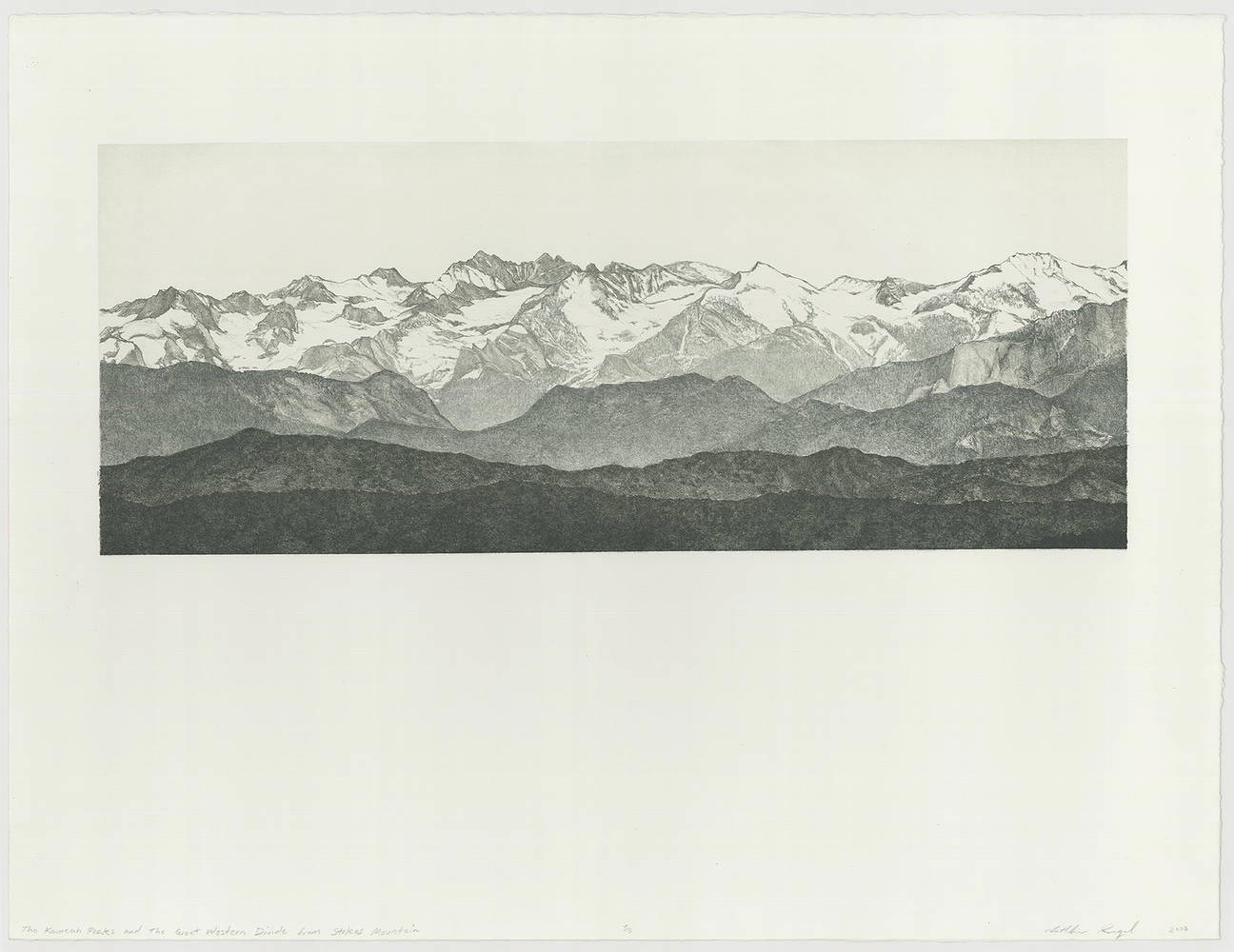
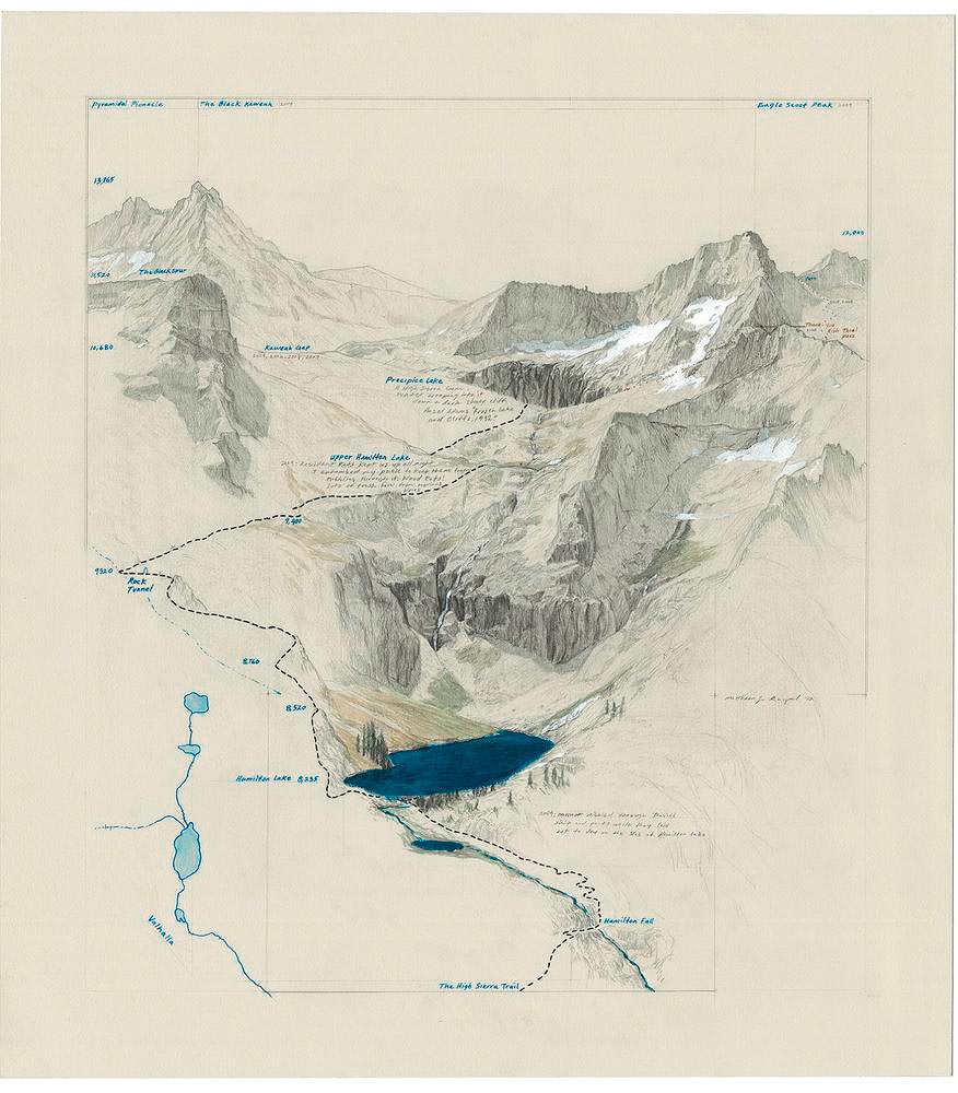
These are some amazing illustrations from Artist Matthew Rangel, that remind me both of old school map/diagrams from the 1800s, and the Taking Measures James Corner’s Map Landscapes. While much of the graphic conventions seem to hover around exploded axonometrics and collage photoshop, the ability of these sketchy images to depict landscapes in map and diagram offers inspiration for displaying complex systems.
Some description, via Socks Studio:
“His digital and analogical prints communicate his thoughtful explorations of mountainous territories made through cross-country hikes, interviews and pictures. Rangel’s works reveal how human beings shape and experience landscape, showing the contrast between the segmentation of a territory in different properties and its natural features.
The practice also reflects on different ages in the relationship between art and landscape, from romanticism to land art. Rangel’s production mixes traditional cartographic features, mostly sections and plans, with annotations, photographs and other drawings to produce narrative-rich and multilayered documents.”
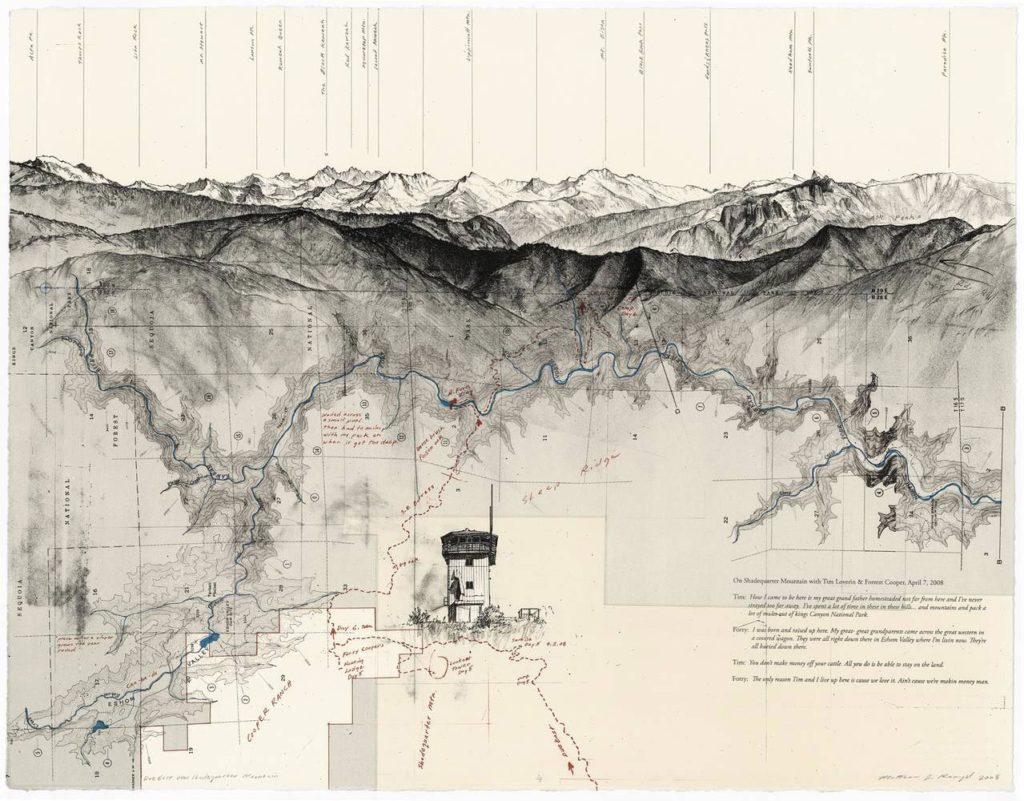
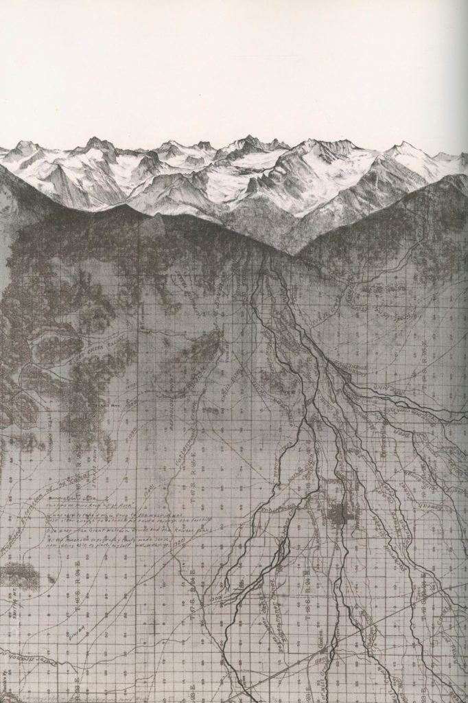
All images © Matthew Rangel – Thanks to link from Twitter @bmeyer56 – images via Socks Studio
One thought on “Map Landscapes by Matthew Rangel”