The previous post outlining the “River Maps” (01.10.14) got me thinking about watersheds and the differences between natural boundary delineation vs. political boundaries. Long-time readers will note the recurrence of the Powell map on Landscape+Urbanism “Natural Boundary/Political Boundary” (11.24.10), which has gotten some more attention lately.
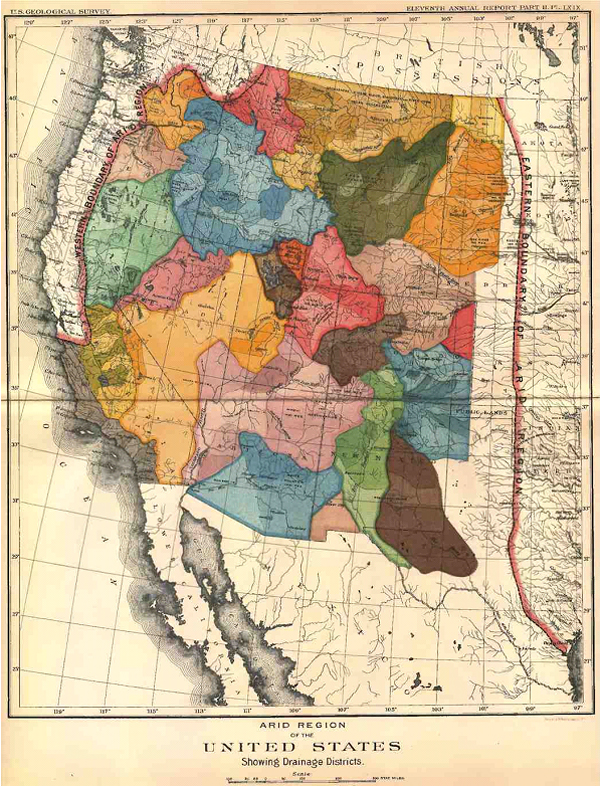
Powell’s map is derived from observation, as mentioned in Strange Maps:
“Powell was convinced that only a small fraction of the American West was suitable for agriculture (3). His Report proposed irrigation systems fed by a multitude of small dams (instead of the few huge ones in operation today) and state borders based on watershed areas. The bulk of the arid regions should be reserved for conservation and low-intensity grazing. But other interests were at work; the railway companies lobbied for large-scale settlement and agricultural development.”
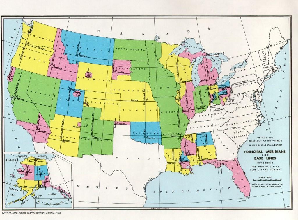
It’s also a counterpoint to the prevalence of the Jeffersonian grid as realized through the through the Public Land Survey System (with a good primer and online tool here – National Atlas). This resulted in the very square patterning of our current state boundaries that we’re all familiar with today.
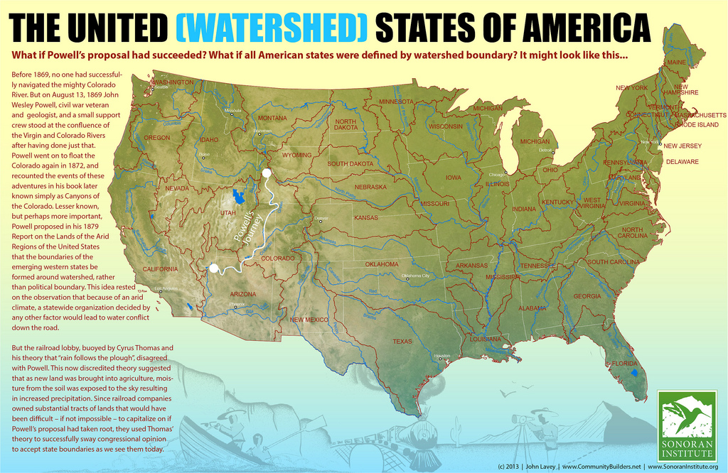
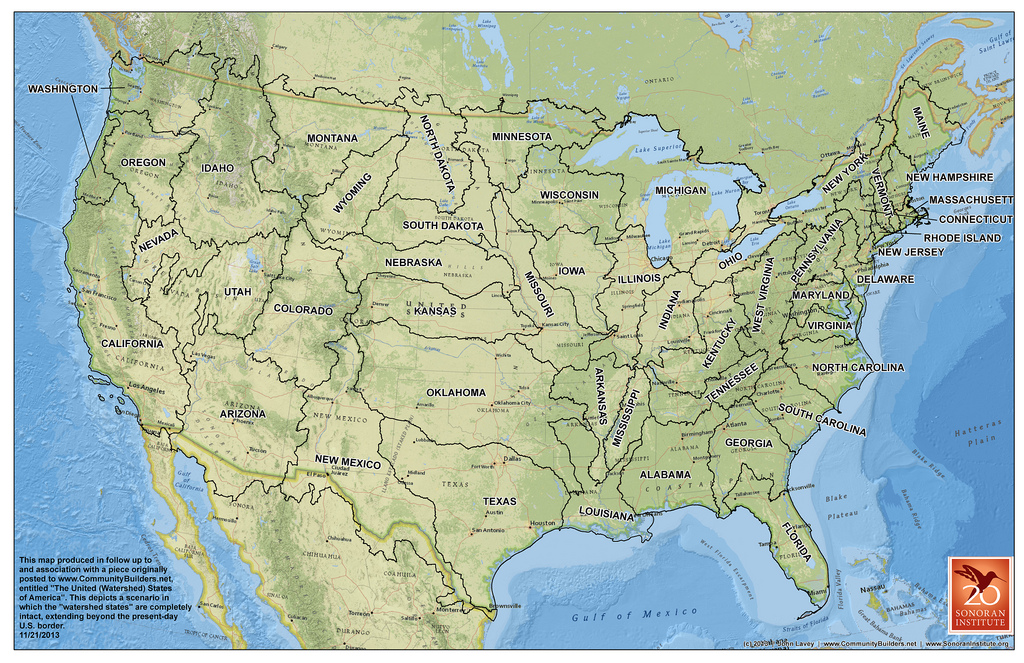
A new map from John Lavey at the Sonoran Institute “The United (Watershed) States of America” takes Powell’s mapping exercise for the west to it’s logical conclusion and re-drew the boundaries within the framework of the continental US states. As mentioned on the site:
Which gets me to my “what if”: What if the Western states were formed around watershed as Powell envisioned? What would that look like and could we speculate on what that might mean for the functioning of modern communities? And since we’re going down that road, let’s ask another what if: What if all of the American states were based around principal watershed, from coast to coast – something even Powell didn’t consider.
The comments on the map are pretty interesting as well – skewering some of the map choices like the Oregon coast being part of Washington, or quibbling over some details. The point is, it’s a much different conversation that you have when you consider natural features as markers of ‘place’. It also flips many boundary notions on their heads, as rivers no longer act as dividers between states and co-managed fringes, but rather become central to the places they inhabit… the central spines of districts.
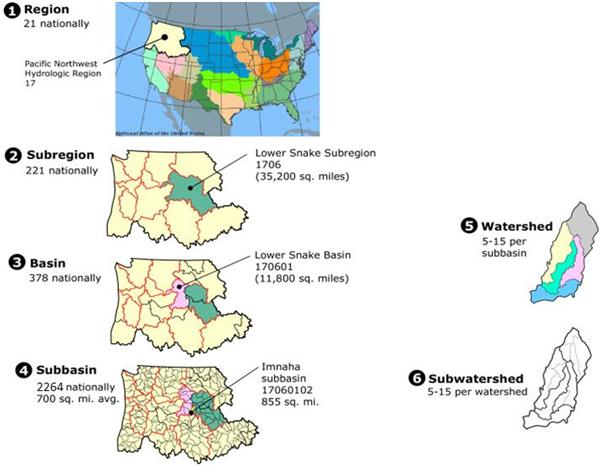
There are obviously innate watershed boundaries that exist already, governed by the size of the catchment area. The ‘Watershed Boundary Dataset‘ shows the United States map with these Hydrologic Unit Codes (HUC) areas delineated for each basin.
And of course I would be remiss if I didn’t delve right into the scalar nature of watersheds, and the nested qualities of their subsequent subdivisions, as the real brilliance to this scheme – imagining the next level down of states as shown on Pacific Northwest Hydrologic Region (HUC 17) below, the subregion, basin, subbasin, watershed and subwatershed.
Eventually, at a certain scale, the subwatershed hits the sweet spot of the NeighborShed, a neighborhood scale basin, which has been on my mind since the ASLA National Conference talk in 2006 and also infused the thinking behind the Open Space Seattle 2100 processes here.
It all seems to come back here… perhaps it’s time to take this to the next level.

Take it to the next level! I’m trying to get the people who make elevated topography map to create a series of maps that can be combined together to make a big wall sized Map of the watershed boundary dataset.