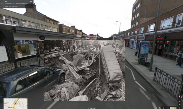
An interesting idea from some of the coverage of Memorial Day, which is a good time to remember the past. The Guardian and the Photography Then and Now, which includes interactive before and after images – essentially exact matching shots of the old and new through historical events. This weekend, they posted some interesting photos of WWII, juxtaposed on top of google street view. For instance, the remnants of bombing in London (top photo) and the Germans on parade down the Champs-Elysées in Paris (both 1940).

It got me thinking that the ability to apply the same process to the historical hydrology. Aided by digital tools and a good eye, you can quickly do a photo match (or map illustration match) and with some minimal tweaks of perspective, provide this unique perspective of old & new in terms of water.
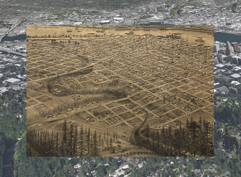
This power can also be applied to the concept of hidden hydrology, as this very quick example below, inspired by the photos above, gives a taste for the potential of this on the historical maps, overlaid with google earth imagery at an approximate perspective. A bit more difficult when you are looking at a broad perspective, but still possible.
One of the interesting illustrative maps of Portland, this small snapshot of a much larger artists illustration (1879) of the aerial view looking from the West Hills toward the east, across the downtown and with the routing of Tanner Creek bridged but not quite yet buried.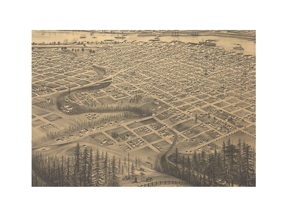
With a few minor tweaks, you get a reasonable photo match. In a subsequent version, I’d try to include more of the current Google Earth view, to give it a bit more of the surrounding context, but you get the idea, and each photo will have it’s own character and story.
The water course of Tanner Creek could potentially be traced along the historical photograph, as it weaves through the West Hills towards the northwest into the Willamette River.
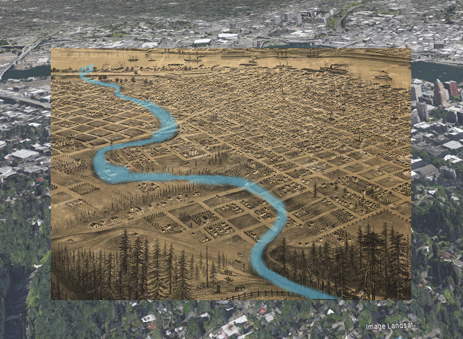
And more of the remnant of the water course as it would have flowed through the current pattern of City. A stream or creek isn’t just a monothematic band of blue either – it evokes an ecology of plant and animal life, as well as the story of use (and misuse) by early settlement and subsequent piping and erasure.
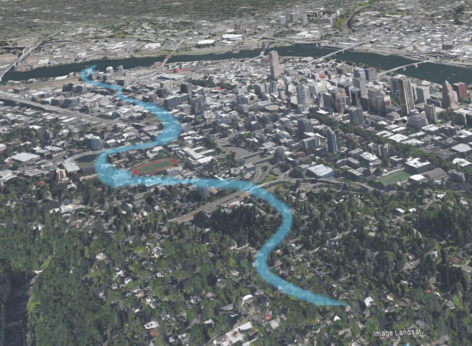
Aside from being an exercise purely to show the old and new – this can also allow us to look at the maps of Tanner Creek from the 1850s and see if this illustration aligns with these – both as a ‘field verification’ and supporting evidence. Imagine the creek weaving through downtown, by PGE Park, Jeld-Wen Field, Providence Park, and etching lazy meanders through the condos of what is now the Pearl District before draining into the Willamette near Centennial Mills.